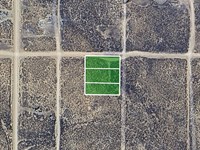
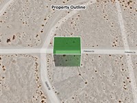
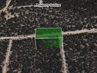
Spacious 1 Acre Vacant Lot
732 S Coronado Rd : Dateland, AZ 85333
Yuma County, Arizona
Lot Description
Dreaming of peace, privacy, and Arizona sunsets? This 1-acre residential lot in Dateland's Sun Country Acres could be just what you're looking for. Whether you want to build a quiet desert retreat, hold it as a future investment, or create a seasonal escape, this property offers flexibility and wide-open potential.
The lot is flat, cleared, and buildable, zoned Sr-1 (Suburban Ranch)-allowing for single-family homes, mobile homes, tiny houses, and more. There's no Hoa, low taxes, and access is easy via a nearby dirt road, giving you the best of both affordability and rural tranquility.
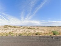
You'll love the surrounding views-big skies, mountain backdrops, and quiet desert charm. Need a break from solitude? Adventure is never far. Grab a world-famous date shake at the Dateland Travel Center, check out the Painted Rock Petroglyph Site, or explore the Castle Dome Mine Museum and Kofa National Wildlife Refuge-all within driving distance.
This is a rare chance to own affordable land in a growing area with natural beauty and future promise. Whether you build now or hold for later, you can't go wrong.
Don't Miss Out on This Amazing Opportunity.
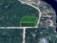
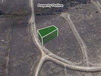
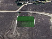
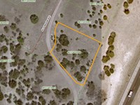
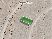
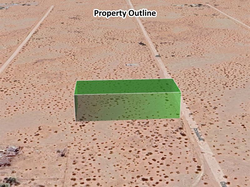
VISIT The Property Today: This lot is located at 732 S Coronado Rd, Dateland, AZ 85333. As it is currently undeveloped, there may not be visible street signage, but you can easily find it using the GPS coordinates (32.813808, -113.513223) or for accurate navigation.
Property Details:
Parcel : R0064177
Property Address: 732 S Coronado Rd, Dateland, AZ 85333/ GPS Center: 32.813808, -113.513223
County: Yuma County
State: Arizona
Parcel Size: 1 Acre
Legal Description: Subdivision: SUN Country Acres Lot: 153 Section: 17 Township: 07S Range: 12W
Land Use: Residential
Property Type: Vacant
GPS Center Coordinates: 32.813808, -113.513223
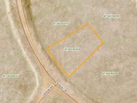
Gps Coordinates (Corners):
32.814040, -113.513750
32.814040, -113.513750
32.813670, -113.512690
32.813670, -113.513750
Tax Amount: $16
Securing your property is easy with us. We use a trusted third-party title company to ensure a clear title and a smooth transaction. Contact us today via message or phone to get started.
Buyer is responsible for verifying all information with the County as to what can and cannot be done with the property. Buyer will need to work with the County to obtain the proper permits if needed. Buyer will also need to confirm the availability of any utilities needed or serviced on the property. Seller makes no warranties or representations about the land, its condition, or what can be built on the property.
More Lot Details
Lot Price History
More Lots from Lisa Foreman
 1.6 AC : $19K
- 0.5 AC : $27K
- 0.2 AC : $4.2K
- 0.2 AC : $4.2K
- 0.3 AC : $4.2K
- 0.3 AC : $4.2K
- 0.5 AC : $13.4K
- 2.5 AC : $31.5K
- 0.8 AC : $12.1K
- 0.1 AC : $4.4K
- 0.2 AC : $5.2K
- 0.5 AC : $8.5K