Arizona's Timeless Beauty
N7904 Petrified Forest Estate : Petrified Forest Natl Pk, AZ 86028
Apache County, Arizona
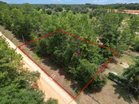
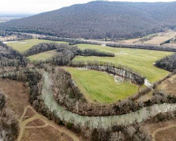
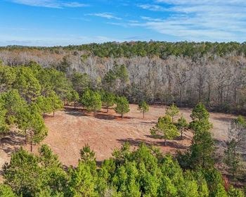
Lot Description
Unique Farmhouse + Balcony - Your Ultra-Affordable Arizona High Desert Haven
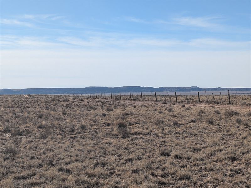
Welcome to one of the most incredible land opportunities in Arizona. This exceptional property in Apache County offers the perfect blend of affordability, natural beauty, and endless possibilities. With stunning high desert scenery, proximity to world-famous attractions, and a price that makes land ownership accessible to virtually anyone, this property is ideal for adventurers, investors, nature lovers, or anyone dreaming of owning their own piece of the Southwest.
Property Address: Apache County, Arizona
Apn: 211-35-235
Property Size: Approximately 1.04 acres (45302.4 square feet)
Zoning: Agricultural General
GPS Coordinates (Center): 35°00'59.8"N 109°50'29.0"W
Elevation: Approximately 5,650 feet
Unbelievable Pricing & Flexible Financing
We're committed to making the dream of land ownership a reality for everyone, which is why we offer two incredibly affordable options:
Cash Purchase Option
Price: $4,000
Own your Arizona property outright for just $4,000. This is one of the most affordable land opportunities in the entire state. At approximately $3,540 per acre, you won't find better value anywhere in Arizona. For less than the cost of a used car, you can own over an acre of beautiful high desert land.
Owner Financing Option - No Credit Check Required.
Make your dream come true with our simple, no-hassle financing:
Down Payment: $99
Document Fee: $200 (one-time)
Monthly Payment: $99
Term: 40 months (3 years 4 months)
Total Investment: $4,259 over 40 months
That's only $3.30 per day to own over an acre of Arizona.
No banks, no credit checks, no lengthy approval process. If you can afford less than $100 down and less than $100 per month, this beautiful Arizona property can be yours. We make land ownership simple, fast, and achievable for everyone.
Incredibly Low Annual Property Taxes
Annual Property Taxes: $3.40
Yes, you read that correctly - just $3.40 per year. That's only $0.28 per month in property taxes. This is one of the absolute lowest tax burdens anywhere in the United States. For less than the cost of a single gallon of gas per year, you can own over an acre of Arizona high desert paradise.
Property Location & GPS Coordinates
This beautiful property is located in Apache County in northeastern Arizona, offering breathtaking high desert scenery and easy access to some of the Southwest's most iconic attractions. Use these precise GPS coordinates to locate and explore your future property:
Decimal Degree Format:
Center Point: 35.016611°N, 109.841389°W
Degrees, Minutes, Seconds Format:
Center Point: 35°00'59.8"N 109°50'29.0"W
Northwest Corner: 35°01'01.2"N 109°50'30.1"W
Northeast Corner: 35°01'01.2"N 109°50'28.3"W
Southwest Corner: 35°00'58.0"N 109°50'30.1"W
Southeast Corner: 35°00'58.3"N 109°50'28.0"W
These coordinates allow you to precisely identify your property boundaries using GPS devices, smartphone mapping apps like Google Maps, or professional surveying equipment.
Ecological Zones:
Your journey showcases Arizona's incredible diversity:
Sonoran Desert (Phoenix, elevation 1,100 feet): Saguaro cacti, desert landscape
Transition Zone (I-17 corridor): Chaparral, juniper, grasslands
Ponderosa Pine Forest (Flagstaff, elevation 6,910 feet): Mountain climate
Colorado Plateau (I-40 east): High desert, painted landscapes
Your Property (elevation 5,650 feet): Perfect high desert climate
Scenic Wonders:
Spectacular elevation changes (nearly 5,000 feet climb from Phoenix)
San Francisco Peaks (12,633 feet) - Arizona's highest mountains
Painted Desert colors
Ponderosa pine forests
Red rock glimpses (if detouring to Sedona)
Services Summary:
Phoenix: All metropolitan services
Black Canyon City (35 miles): Gas, food, basic services
Cordes Junction (65 miles): Gas, food
Camp Verde (85 miles): Full small-town services
Flagstaff (145 miles): Major Stop - Full services, last big city
Winslow (202 miles): Gas, food, basic services
Holbrook (232 miles): Gas, food, supplies - near property area
Travel Tips:
Fuel up in Flagstaff - most convenient major stop
Winter weather: I-17 north of Black Canyon and I-40 near Flagstaff can have snow/ice
Summer heat: Phoenix can exceed 110°F in summer; Flagstaff and property much cooler
Timing: Allow 4-4.5 hours with stops
Best seasons: Spring (March-May) and fall (September-November) offer ideal temperatures
Attractions:
"Standin' on the Corner" park (Eagles' "Take It Easy")
Historic downtown
Route 66 heritage
Continue to Holbrook (mile 87):
Full services available:
Multiple gas stations
Chain restaurants (McDonald's, Sonic, Pizza Hut, etc.)
Grocery stores
Hotels and motels
Wigwam Village Motel (Route 66 icon)
Near Petrified Forest National Park:
North entrance just off I-40
218 million-year-old petrified wood
Painted Desert badlands
Well worth visiting
Why Flagstaff is Special:
Flagstaff serves as the perfect base for exploring your property and the region:
City Amenities:
Population: ~75,000 (metro: ~145,000)
Northern Arizona University (12,000+ students)
Full shopping and services
Medical facilities including hospital
Cultural attractions and museums
Outdoor recreation hub
Natural Setting:
Elevation: 6,910 feet (four-season mountain climate)
Ponderosa pine forest
San Francisco Peaks (12,633 feet) - sacred to multiple tribes
Snow skiing in winter (Arizona Snowbowl)
Cool summer temperatures
Unique Features:
International Dark Sky City - excellent stargazing
Historic Route 66 corridor
Gateway to Grand Canyon (80 miles north)
Lowell Observatory (where Pluto was discovered)
Museum of Northern Arizona
Vibrant downtown with local shops and restaurants
Craft brewery scene
Timing from Flagstaff:
Driving time: 2 hours to 2 hours 15 minutes
Distance: Approximately 122 miles
Easy interstate drive with services available
Year-round access (winter weather can occasionally impact I-40)
From Las Vegas, Nevada (Approximately 332 miles, 5 hours)
Las Vegas provides western access via one of America's most scenic drives through diverse landscapes.
Route via Us-93 S and I-40 E (Recommended Route):
Start in Las Vegas
Downtown or Strip area
Access Us-93 S (also known as I-11 in sections)
Take Us-93 S toward Arizona
Leave Las Vegas metro area
Enter Mojave Desert landscape
Pass through Boulder City
Optional detour: Hoover Dam
One of America's greatest engineering achievements
Tours available
Spectacular views
Well worth the short detour
Cross into Arizona via Us-93 S
Cross Hoover Dam bypass bridge (spectacular views)
Enter Arizona
Drive through rugged desert canyon country
Continue on Us-93 S through Arizona
Pass through Dolan Springs
Continue toward Kingman area
Beautiful desert and mountain scenery
Reach Kingman, Arizona (approximately 105 miles from Las Vegas)
Historic Route 66 town
Full services available:
Gas stations (multiple locations)
Restaurants (chains and local)
Grocery stores (Walmart, Safeway)
Hotels and motels
Good place to stop for fuel and food
Take I-40 E from Kingman (merge from Us-93 onto I-40 E)
Head east across northern Arizona
Follow transcontinental interstate route
Continue on I-40 E across Arizona (approximately 227 miles from Kingman)
Major stops along I-40:
Seligman (mile 50 from Kingman): Historic Route 66 town
Gas and food
Retro Route 66 atmosphere
Delgadillo's Snow Cap (famous roadside attraction)
Williams (mile 80 from Kingman): Gateway to Grand Canyon
Full services
Gas, restaurants, hotels
Grand Canyon Railway departure point
Historic downtown
Flagstaff (mile 115 from Kingman): Major city
Recommended major stop
Full services and supplies
Restaurants and hotels
Northern Arizona University
Last major city before property
Winslow (mile 172 from Kingman): Route 66 town
Gas and food
"Standin' on the Corner" park
Holbrook (mile 202 from Kingman): Near property area
Gas, food, services
Near Petrified Forest
Navigate to property from I-40
Property located in Apache County
Use GPS coordinates (35°00'59.8"N 109°50'29.0"W)
Exit I-40 at appropriate location
Follow local roads to property
Journey Highlights:
Engineering Marvels:
Hoover Dam and Lake Mead
Mike O'Callaghan-Pat Tillman Memorial Bridge
Historic Route 66 alignment
Landscape Transitions:
Mojave Desert (Las Vegas)
Canyon country (Arizona border)
High desert plateau (northern Arizona)
Ponderosa pine forests (Flagstaff)
Painted Desert (eastern Arizona)
Historic Route 66:
Much of I-40 follows the original Route 66 alignment, providing nostalgia and Americana throughout your journey.
Services and Timing:
Las Vegas: All metropolitan services
Boulder City (25 miles): Gas, food, services
Kingman (105 miles): Full services - recommended stop
Seligman (155 miles): Gas, food, Route 66 charm
Williams (185 miles): Full services
Flagstaff (220 miles): Full services - major stop
Holbrook (307 miles): Gas, food - near property
Total driving time: 5 to 5.5 hours with stops
Best times: Spring and fall for comfortable temperatures throughout
From Albuquerque, New Mexico (Approximately 192 miles, 3 hours)
Albuquerque provides the easiest and most direct access from the east via Interstate 40.
Route via I-40 W (Primary and Simplest Route):
Start in Albuquerque
Downtown area or I-25/I-40 interchange
New Mexico's largest city with full services
Head west on I-40 W
Leave Albuquerque metro area
Cross the Rio Grande
Begin journey across New Mexico high desert
Continue west on I-40 W across New Mexico (approximately 150 miles in Nm)
Major landmarks and stops in New Mexico:
Laguna Pueblo (mile 45): Native American pueblo
Dancing Eagle Casino
Limited services
Historic pueblo visible from highway
Acoma Pueblo (south of I-40): "Sky City"
Ancient pueblo atop 365-Foot sandstone mesa
Continuously inhabited since ~1150 Ad
Guided tours available (detour required)
Grants (mile 80): Significant mid-route services
Recommended stop
Gas stations (multiple)
Restaurants (chains and local)
Grocery stores (Walmart)
Hotels and motels
Mining Museum (uranium mining heritage)
El Malpais National Monument area: Ancient lava flows
Visible from highway
Visitor center and hiking (if you have time)
Spectacular volcanic landscape
Continental Divide (mile 105): Elevation 7,275 feet
Highest point on I-40 between North Carolina and California
Rest area with views
Watershed divide (Pacific vs Atlantic drainage)
Gallup (mile 140): Last major New Mexico city
Important services stop
Full services available:
Multiple gas stations
Chain restaurants (McDonald's, Sonic, etc.)
Grocery stores
Hotels and motels
Known as "Heart of Indian Country"
Trading posts with Native American arts and crafts
Route 66 heritage and historic downtown
Recommended final New Mexico stop for fuel
Cross into Arizona (just west of Gallup at mile ~150)
Welcome to Arizona signs
Enter Apache County, Arizona
Mountain time zone (no change - both states observe Mst)
Continue on I-40 W in Arizona (approximately 40 miles)
High desert plateau scenery
Painted Desert landscapes
Wide-open vistas
Navigate to property area
Property is in Apache County north of I-40
Use GPS coordinates (35.016611°N, 109.841389°W) for exact navigation
Exit I-40 at appropriate location near property
Follow county and area roads to property
Property is accessible from area roads
Why This Route is Special:
Shortest Drive:
This is the shortest route to your property from any major city, making Albuquerque an ideal gateway for property visits.
Scenic Beauty:
Rio Grande Valley
New Mexico mesas and volcanic landscapes
Continental Divide crossing
Painted Desert vistas
High desert plateau (6,000-7,000+ feet elevation)
Cultural Richness:
Native American pueblos (some continuously inhabited for 1,000+ years)
Historic Route 66 corridor
Trading posts and Native arts
Southwestern architecture and culture
Mining and railroad heritage
Elevation Profile:
Albuquerque: 5,312 feet
Continental Divide: 7,275 feet (highest point)
Gallup: 6,515 feet
Property area: ~5,650 feet
Comfortable high desert elevation throughout
Services Summary:
Albuquerque (mile 0): All metropolitan services
International airport
Major shopping and dining
Cultural attractions
Full amenities
Laguna (mile 45): Gas, casino, limited services
Grants (mile 80): Full small-town services
Good mid-route stop
Gallup (mile 140): Full services
Recommended final fuel stop before property
Last major city
Apache County, AZ: Property area
Holbrook (nearest Arizona town with services)
Timing and Conditions:
Driving time: 3 hours to 3 hours 30 minutes
Distance: Approximately 192 miles
Easiest route: Entirely interstate, well-maintained
Weather:
Winter: Snow/ice possible at Continental Divide and higher elevations
Summer: Warm but manageable, afternoon thunderstorms possible in monsoon
Spring/Fall: Ideal temperatures and conditions
Year-round access: Generally excellent, check weather in winter
Points of Interest for Future Visits:
El Malpais National Monument: Lava tubes, cinder cones, ice caves
El Morro National Monument: Inscription Rock (2,000 years of carvings)
Acoma Pueblo: Sky City tours
Gallup: Red Rock Park, cultural events, trading posts
Petrified Forest National Park: Just off I-40 in Arizona
This route offers the quickest, easiest access to your property with good services throughout and spectacular scenery all the way.
About Apache County, Arizona
Apache County, located in the northeastern corner of Arizona, is part of the magnificent Colorado Plateau and offers some of the Southwest's most spectacular scenery, rich cultural heritage, and outdoor recreation opportunities.
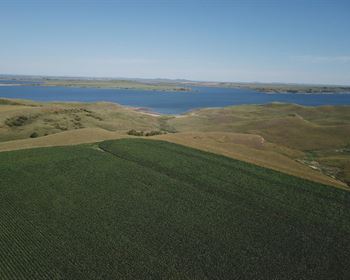
Geographic Setting & Natural Beauty
Location:
Northeastern corner of Arizona
Borders New Mexico to the east
Part of Colorado Plateau physiographic province
High desert elevation (5,000-7,000+ feet)
Landscape Features:
Painted Desert badlands
High desert mesas and plateaus
Colorful sandstone formations
Ancient volcanic features
Grasslands and sagebrush plains
Pinyon-juniper woodlands
Wide-open panoramic vistas
Dramatic geological formations
Climate:
Four distinct seasons with high desert character
Elevation advantage: Cooler summers than Phoenix (20-30°F cooler)
Winter: Cold with occasional snow (beautiful when it occurs)
Summer: Warm days (60-90°F), cool nights (50-60°F)
Monsoon season: July-August afternoon thunderstorms
Low humidity: Comfortable year-round
Abundant sunshine: Over 300 days per year
Clear skies: Excellent for stargazing
World-Famous Attractions Nearby
Apache County provides access to some of America's most iconic natural wonders:
Petrified Forest National Park (25-40 miles):
218 million-year-old petrified wood
Largest concentration of petrified wood in the world
Painted Desert badlands (spectacular colors)
Ancient petroglyphs and pueblo ruins
Blue Mesa (brilliant blue and purple badlands)
Crystal Forest trail
Route 66 alignment through park
Free entrance on certain days
Canyon de Chelly National Monument (~80 miles):
Sacred Navajo land with dramatic sandstone canyons
1,000-foot canyon walls
Ancient Ancestral Puebloan cliff dwellings
Spider Rock - 800-Foot sandstone spire
White House Ruins trail
Navajo-guided tours
Free admission
Spectacular photography opportunities
Monument Valley (~120 miles north):
Iconic sandstone buttes and mesas
Featured in countless Western films
Navajo Tribal Park
Guided tours by Navajo guides
Sunrise/sunset photography
Visitor center and museum
Scenic drive through valley
Other Nearby Attractions:
Hubbell Trading Post National Historic Site: Operating since 1878
Window Rock: Navajo Nation capital with natural arch
Painted Desert: Colorful badlands extending for miles
Little Colorado River Gorge: Deep canyon with river views
Homolovi State Park: Ancient pueblo ruins
Meteor Crater: 50,000-Year-Old impact crater (~60 miles)
Cultural Heritage
Apache County has extraordinary cultural significance:
Native American Heritage:
Large portions of Navajo Nation (Diné)
Hopi Reservation (ancient mesa-top villages)
Apache tribal heritage
Living traditional cultures
Ancient Ancestral Puebloan sites (dating back 2,000+ years)
Sacred sites and ceremonial areas
Historic Significance:
Historic Route 66 corridor
Transcontinental railroad heritage
Old West history and trading posts
Ancient Native American trade routes
Spanish colonial exploration routes
Cultural Experiences:
Native American arts and crafts
Traditional weaving and pottery
Trading posts (some operating for 100+ years)
Cultural events and ceremonies (some open to visitors)
Museums and interpretive centers
Wildlife & Nature
The high desert ecosystem supports diverse wildlife:
Large Mammals:
Pronghorn antelope (North America's fastest land animal)
Mule deer
Elk (in higher elevations and mountains)
Coyotes (commonly heard at night)
Bobcats
Mountain lions (rarely seen but present)
Black bears (in mountain areas)
Foxes
Birds:
Golden eagles (majestic raptors)
Red-tailed hawks
Prairie falcons
American kestrels
Ravens and crows
Roadrunners
Great horned owls
Burrowing owls
Various songbirds and migratory species
Other Wildlife:
Black-tailed jackrabbits
Desert cottontails
Ground squirrels and prairie dogs
Lizards (multiple species including collared lizards)
Snakes (including rattlesnakes - use caution)
Tarantulas (especially in late summer)
Climate Details by Season
Spring (March-May):
Daytime: 50-75°F
Nighttime: 30-50°F
Wildflower blooms in wet years
Variable weather with occasional winds
Beautiful fresh air
Ideal for outdoor activities
Summer (June-August):
Daytime: 75-90°F
Nighttime: 50-65°F
Monsoon season (July-August) brings afternoon thunderstorms
Dramatic clouds and lightning displays
Much cooler than Phoenix
Low humidity makes heat comfortable
Fall (September-November):
Daytime: 50-75°F
Nighttime: 30-50°F
Spectacular weather
Clear blue skies
Comfortable temperatures
Brilliant sunsets
Excellent for hiking and outdoor activities
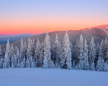
Winter (December-February):
Daytime: 35-55°F
Nighttime: 15-30°F
Occasional snow (creates stunning landscapes)
Cold nights
Sunny days common
True winter experience
Beautiful for photography
Precipitation:
Annual: 8-12 inches
Summer monsoon: 50% of annual precipitation
Winter: Light snow and rain
Generally dry climate
Low humidity year-round
Cost of Living & Taxes
Apache County offers exceptional affordability:
Property Taxes:
Among the lowest in the nation
This property: only $3.40 annually.
Virtually free to own
No financial burden
Arizona Tax Environment:
State income tax exists (2.5-4.5% graduated rates)
But incredibly low property taxes on vacant land compensate
No inheritance or estate tax
Sales tax: ~9-10% (combined state/county)
Rural Living Costs:
Lower than Phoenix or Tucson
Affordable compared to most of Usa
No HOA fees or restrictions
Freedom to live how you choose
What Makes This Property Special?
Extreme Affordability
This property represents extraordinary value:
Cash Price: $4,000
One of Arizona's most affordable land opportunities
Approximately $3,540 per acre
Less than cost of a used car
Perfect for first-time land buyers
Incredible investment opportunity
Owner Financing: $99 down, $99/Month for 40 months
Ultra-low barrier to entry
Less than $100 to get started
No credit check required
Build equity from day one
Total cost: $4,259 over 40 months
Still exceptional value
Annual Taxes: $3.40
Virtually free to own
Less than cost of monthly streaming service
One of lowest tax rates in America
Makes long-term holding effortless
Property Size & Features
At approximately 1.13 acres, this property offers:
Adequate space for various uses
Building site with room for structures
Privacy and elbow room
Flexibility for different purposes
Recreational opportunities
Investment and appreciation potential
Natural setting with high desert beauty
Natural Beauty & Setting
Scenic Views:
High desert panoramas
Mountain vistas in distance
Big sky country
Spectacular sunrises and sunsets
Painted Desert colors
Dramatic cloud formations
Dark night skies perfect for stargazing
Environment:
High desert elevation (~5,650 feet)
Natural high desert vegetation
Clean, fresh air
Peaceful and quiet
Connection to nature
Four-season climate
Location Advantages
Accessibility from Major Cities:
Phoenix: 232 miles
Flagstaff: 122 miles
Albuquerque: 192 miles
Las Vegas: 332 miles
Proximity to Attractions:
Petrified Forest National Park nearby
Canyon de Chelly within driving distance
Monument Valley accessible
Route 66 corridor
Native American cultural sites
Investment Factors:
Arizona population growth continues
Northeastern Arizona gaining recognition
Tourism to region strong
Low entry cost
Minimal carrying costs ($3.40 annual taxes.)
Appreciation potential
Possible Uses for Your Property
Recreational Paradise
Weekend getaway - escape city stress
Camping base - explore region from your land
Stargazing haven - dark skies, Milky Way visible
Photography location - capture stunning landscapes
Off-road adventures - explore high desert
Nature observation - wildlife watching
Outdoor activities - hiking, rockhounding, exploring
Family gathering spot - create memories
Residential Possibilities
Off-Grid Living:
Perfect for sustainable lifestyle
Solar power highly viable (300+ sunny days)
Well water or water hauling
Septic system for waste
Escape the grid and live freely
Housing Options:
Small cabin or cottage
Manufactured home
Tiny house
RV or mobile home (check county regulations)
Weekend retreat structure
Future retirement home site
Investment Strategy
Hold for appreciation - Arizona land values trend upward
Minimal carrying costs - only $3.40 annual taxes.
Build equity - if using owner financing
Resale potential - affordable land always in demand
Tangible asset - real property ownership
Legacy property - pass to future generations
Other Uses (Verify Regulations)
Small-scale agriculture - high desert gardening
Livestock (check Apache County regulations)
Homesteading - self-sufficient living
Artist retreat - inspiration and solitude
Writer's escape - peaceful environment
Building and Development Considerations
Utilities & Infrastructure
Electricity:
Check with local utility providers for grid availability
Off-grid solar extremely viable in Arizona sunshine
Solar system costs: $15,000-$35,000 for full home
Battery backup systems available
Many rural residents choose solar
Generator backup option
Water:
Well drilling possible (check local depths and costs)
Typical depths vary by location
Water hauling available from local sources
Rainwater catchment (verify Arizona regulations)
Conservation practices important in desert
Waste Management:
Septic system required for permanent residence
Standard septic: $8,000-$15,000 typically
Alternative systems available
Apache County regulations apply
Professional installation recommended
Internet & Communications:
Satellite internet available everywhere
Starlink offers high-speed rural service
HughesNet and Viasat also available
Cell service varies by carrier and exact location
Signal boosters can improve reception
Offline capability important for remote areas
Building Regulations
County Requirements:
Contact Apache County Planning & Zoning
Research building permit requirements
Setback regulations may apply
Some structures may not require permits
Regulations vary by structure type and use
Contact Information:
Apache County Planning & Zoning
Apache County Building Department
Research online or call for specific requirements
Climate Considerations for Building:
Design for four seasons
Insulation for winter cold
Ventilation for summer warmth
Solar orientation for passive heating/cooling
Wind protection
Foundation appropriate for soil type
Construction Approach:
DIY possible for some projects
Licensed contractors for major work
Materials available in Holbrook, Flagstaff, or Gallup
Plan logistics for remote location
Water and power during construction phase
Recreation & Lifestyle Opportunities
On-Property Activities
Your property enables:
Primitive camping - sleep under the stars
Stargazing - Milky Way clearly visible
Wildlife observation - watch desert species
Photography - landscapes and wildlife
Outdoor living - fresh air and space
Target practice - safe distances (follow safety protocols)
Metal detecting - search for treasures (follow regulations)
Rockhounding - search for interesting rocks and minerals
Nature study - learn high desert ecosystem
Meditation and yoga - peaceful setting
Art and creativity - inspiring environment
Regional Exploration
National Parks & Monuments:
Petrified Forest National Park
Canyon de Chelly National Monument
Hubbell Trading Post Nhs
Homolovi State Park
Grand Canyon (via Flagstaff)
Sunset Crater Volcano NM (via Flagstaff)
Wupatki National Monument (via Flagstaff)
Natural Wonders:
Painted Desert
Little Colorado River Gorge
Monument Valley
White Mountains (summer escape)
Meteor Crater
Various slot canyons
Cultural Experiences:
Navajo Nation cultural sites and events
Hopi villages and cultural center
Historic trading posts
Native American arts and crafts
Route 66 heritage sites
Museums and interpretive centers
Historic Sites:
Ancient pueblo ruins
Petroglyphs and pictographs
Historic Route 66 landmarks
Old trading posts
Ghost towns
Railroad history
Outdoor Activities
Hiking on public lands and trails
Rockhounding and mineral collecting
Off-road vehicle exploration
Photography - landscapes, wildlife, night sky
Birding - diverse species
Wildlife viewing - pronghorn, deer, eagles
Camping - primitive and developed sites
Horseback riding on trails
Mountain biking in suitable areas
Fishing in White Mountains (higher elevations)
Hunting (appropriate licenses and seasons)
Getting Started with Your Purchase
Simple Purchase Process
Cash Purchase ($4,000):
Review Property
Visit
Review all photos, maps, and information
Explore location using GPS coordinates on Google Earth
Contact Us
Call or email with any questions
Discuss property details
Schedule property visit if desired
Visit Property (Highly Recommended)
Use detailed directions and GPS coordinates
Walk the property boundaries
Take photos and videos
Envision your plans
Purchase Agreement
Simple, straightforward paperwork
Review terms carefully
Sign and return
Quick Closing
Fast closing process
Minimal hassle
Title transferred to you
Receive Your Deed
Warranty deed recorded in Apache County
You're an Arizona landowner.
Owner Financing ($99 down, $99/Month for 40 months):
Initial Contact
Discuss property and financing terms
Ask any questions
No credit check required.
Simple Application
Basic information only
Quick approval process
No complicated paperwork
Down Payment
Just $99 down payment
$200 document fee (one-time)
Total to start: $299
Sign Agreement
Clear, simple terms
No hidden fees
Monthly payment: $99
Begin Payments
40 easy monthly payments
Build equity with each payment
Own the property from day one
Receive Full Deed
Upon completion of 40 payments
Free and clear ownership
Warranty deed transferred to your name
Important Due Diligence
Visit the Property:
See it with your own eyes
Walk boundaries using Gps
Experience the area and surroundings
Take photos and measurements
Check access routes
Research:
Contact Apache County for zoning information
Verify building requirements
Check utility availability and costs
Confirm tax information
Review flood maps (typically low risk)
Research well depths in area
Professional Services (Optional but Recommended):
Professional survey for exact boundaries: $1,500-$2,500
Title insurance for protection: $500-$1,000
Soil testing if planning to build: $500-$1,500
What to Bring When Visiting
Essential Items:
GPS device or smartphone with offline maps downloaded
Property GPS coordinates (provided above)
Camera and video recorder
Plenty of water (minimum 1 gallon per person)
Snacks and food
Full tank of gas (services can be spread out)
Appropriate clothing for season and weather
Sun protection: hat, sunscreen, sunglasses
First aid kit
Spare tire and basic tools
Flashlight or headlamp
Binoculars for viewing distant features
Compass for orientation
Paper maps as backup
Notebook for observations
Seasonal Considerations:
Summer: Extra water, sun protection, visit early morning
Winter: Warm layers, check weather, possible snow
Spring/Fall: Layers for temperature changes
Monsoon season (July-Aug): Watch weather, lightning safety
Safety Reminders:
Tell someone your plans and expected return
Check weather forecast before departure
Carry extra supplies (water, food, blankets)
Watch for wildlife - maintain safe distance
Be aware of rattlesnakes in warm months
Cell service may be limited - plan accordingly
Respect all private property boundaries
Stay on designated roads and trails
Frequently Asked Questions
Q: What can I build on this property?
A: Apache County zoning typically allows residential structures. Contact Apache County Planning & Zoning for specific requirements for your intended use.
Q: Is water available?
A: You'll need to develop water via well drilling or water hauling. Contact local well drillers for typical depths and costs in the specific area.
Q: Can I live there full-time?
A: Full-time living depends on building a permitted structure and meeting county requirements. Contact Apache County for specific regulations.
Q: What about electricity?
A: Check with local utilities for grid availability and connection costs. Off-grid solar is extremely viable and popular in rural Arizona.
Q: Are there building restrictions?
A: Apache County has building codes and zoning. Contact the county for specific requirements for your planned structures.
Q: Why are the taxes so incredibly low?
A: Arizona taxes vacant land at very low rates. Once you improve the property with structures, taxes increase based on assessed improvements.
Q: Can I pay off the financing early?
A: Yes. Early payoff is typically allowed with no prepayment penalties. Contact us for the current payoff balance.
Q: Is this a good investment?
A: Arizona land has historically appreciated in value, and the minimal carrying costs ($3.40 annual taxes) make it very affordable to hold long-term.
Q: What wildlife will I see?
A: Common wildlife includes pronghorn antelope, coyotes, jackrabbits, various hawks and eagles, roadrunners, and other high desert species.
Q: What's the weather like?
A: Four distinct seasons with warm summers (75-90°F), cool winters (35-55°F), possible winter snow, low humidity, and over 300 sunny days per year.
Q: Are there any HOA fees or restrictions?
A: No Hoa, no covenants, no restrictions beyond Apache County regulations. You have maximum freedom.
Q: Is owner financing really with no credit check?
A: Yes. We don't check credit. If you can make the $99 down payment and $99 monthly payments, the property is yours.
Q: What's the nearest town with services?
A: Holbrook is the nearest Arizona town with full services (gas, groceries, restaurants, lodging), approximately 20-30 miles depending on exact property location.
Q: Can I see stars at night?
A: Absolutely. With virtually no light pollution, the night skies are spectacular. The Milky Way is clearly visible on clear nights.
Q: How close is Petrified Forest National Park?
A: Approximately 25-40 miles depending on which entrance, making it very accessible for frequent visits.
Q: Is the property flat or hilly?
A: The property features typical high desert terrain. View it in person or via Google Earth to assess specific topography.
Q: Can I visit before buying?
A: Absolutely. We encourage all potential buyers to visit the property before purchasing. Use the GPS coordinates and directions provided.
Why Choose H5 Land Ventures?
Our Commitment to You:
Transparent Pricing - What you see is what you pay, no surprises
Accurate Information - GPS coordinates and honest descriptions
Accessible Financing - No credit check, ultra-affordable terms
Quality Properties - Carefully selected parcels with real value
Responsive Service - We're here to answer questions and help
Simple Process - Quick, efficient closings without hassle
Fair Terms - No prepayment penalties or hidden fees
Customer Success - We want you to love your land
Experience You Can Trust:
We've helped hundreds of people achieve their land ownership dreams with affordable properties and flexible financing.
Your Arizona Dream Awaits
This exceptional property in Apache County represents one of the most affordable land opportunities in the entire state of Arizona. With a cash price of just $4,000 or owner financing for only $99 down and $99 per month, land ownership is within reach of virtually anyone.
Property Summary:
Location: Apache County, Arizona
Apn: 211-35-235
Size: Approximately 1.13 acres
Cash Price: $4,000
Owner Financing: $99 down + $200 fee, then $99/Month for 40 months
Annual Taxes: Only $3.40.
Gps Center: 35°00'59.8"N 109°50'29.0"W
Why This Property is Exceptional:
Ultra-affordable - just $4,000 cash
Incredibly low financing - only $99 down
Virtually free taxes - $3.40 per year
Beautiful high desert setting
Near Petrified Forest National Park
Near Canyon de Chelly and Monument Valley
Four-season comfortable climate
Dark skies for amazing stargazing
Strong investment potential
Arizona living at its most affordable
Visit our website for more information, photos, and virtual tours:
Don't miss this incredible opportunity to own Arizona high desert land at one of the most affordable prices anywhere.
Whether you're seeking a weekend escape, investment property, future retirement site, recreational base camp, or simply want to own a piece of the beautiful Southwest, this property delivers exceptional value at an unbeatable price.
Contact us today to make this property yours.
Your affordable Arizona high desert haven awaits. Start your journey today.
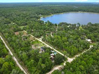
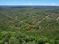
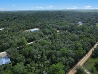
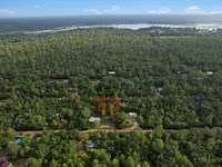
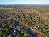
Lot Maps
Directions to Lot
Detailed Directions to the Property
From Phoenix, Arizona (Approximately 232 miles, 3 hours 45 minutes)
Phoenix, Arizona's vibrant capital and fifth-largest city in the United States, provides excellent access to your high desert property.
Route via I-17 N and I-40 E (Primary and Recommended Route):
Start in downtown Phoenix
Begin at the I-10/I-17 interchange (The Stack)
This is Phoenix's main interstate junction
Head north on I-17 N (Black Canyon Freeway)
Exit onto I-17 N heading toward Flagstaff
Drive through northern Phoenix metro area
Pass through suburbs (Deer Valley, New River, Anthem)
Begin ascending from Sonoran Desert into higher elevations
Continue on I-17 N through central Arizona (approximately 145 miles total)
Major landmarks and stops:
Black Canyon City (mile 35): Gas and food available
Sunset Point Rest Area (mile 40): Beautiful views, restrooms
Cordes Junction (mile 65): Gas, food, services
Bumble Bee - historic mining area
Cleator - ghost town visible from highway
Camp Verde (mile 85): Town with services
Montezuma Castle National Monument nearby (ancient cliff dwelling)
Verde Valley wine country
Sedona turnoff (mile 95): Optional 30-mile detour to red rock country
Oak Creek Canyon - stunning scenic drive
Flagstaff approach - climb through ponderosa pine forests
Flagstaff (mile 145): Major city with full services
Highly recommended stop for fuel and supplies
Gas stations (multiple brands)
Restaurants (chains and local options)
Grocery stores (Safeway, Walmart, Whole Foods, Bashas')
Northern Arizona University
Historic downtown and Route 66
Last major city before property
Merge onto I-40 E at Flagstaff
Take I-40 E toward Winslow/Holbrook/Albuquerque
Continue east across high plateau
Drive east on I-40 E (approximately 87 miles on I-40)
Points of interest along the way:
Walnut Canyon National Monument (exit 204): Ancient cliff dwellings
Meteor Crater (exit 233): 50,000-year-old impact crater
Privately operated attraction
Impressive geological feature
Worth visiting if you have time
Winslow (mile 57 from Flagstaff): Historic Route 66 town
"Standin' on the Corner" park (Eagles song)
La Posada Hotel - architectural gem
Gas and food available
Holbrook (mile 87 from Flagstaff): Last significant services
Multiple gas stations
Fast food and restaurants
Petrified Forest National Park entrance nearby
Historic Wigwam Village Motel
Dinosaur statues and Route 66 kitsch
Navigate to property area from I-40
Property is in Apache County northeast of I-40 corridor
Use GPS coordinates (35°00'59.8"N 109°50'29.0"W) to navigate precisely
Exit I-40 at appropriate location for property access
Follow county roads to property area
From Flagstaff, Arizona (Approximately 122 miles, 2 hours)
Flagstaff, Arizona's mountain city and gateway to the Grand Canyon, is the closest major city to your property.
Route via I-40 E (Primary Route):
Start in downtown Flagstaff
Historic downtown near Route 66
Northern Arizona University area
Multiple I-40 access points
Access I-40 E
Head east toward Winslow/Holbrook/Albuquerque
Leave ponderosa pine forests
Descend to high plateau
Continue east on I-40 E (approximately 87 miles to Holbrook area)
Mile-by-mile highlights:
Walnut Canyon (mile 7): Ancient cliff dwellings worth visiting
Winona (mile 15): Small community
Two Guns (mile 30): Abandoned Route 66 site, historic
Meteor Crater turnoff (mile 40): Exit 233
One of Earth's best-preserved impact craters
50,000 years old, 550 feet deep
Visitor center and guided tours
Fee required for access
Winslow (mile 57): Historic Route 66 town
Services available:
Gas stations (multiple)
Fast food (McDonald's, Subway, etc.)
Local restaurants
Convenience stores
La Posada Hotel (historic Harvey House)
Navigate to property from I-40
Property is in Apache County north/northeast of Holbrook area
Use GPS coordinates (35.016611°N, 109.841389°W) for precise navigation
Exit at appropriate location
Follow county and area roads to property
More Lot Details
More Lots from David Healy
 0.2 AC : $15K
- 0.4 AC : $15K
- 3 AC : $19K
- 0.2 AC : $7.5K
- 0.6 AC : $38K
- 0.5 AC : $30K
- 0.2 AC : $16K
- 0.4 AC : $20K
- 1.3 AC : $8K
- 0.2 AC : $10K
- 0.2 AC : $9K
- 0.2 AC : $9K