Backing Up To Scott Creek, Power
Chiloquin, OR 97624
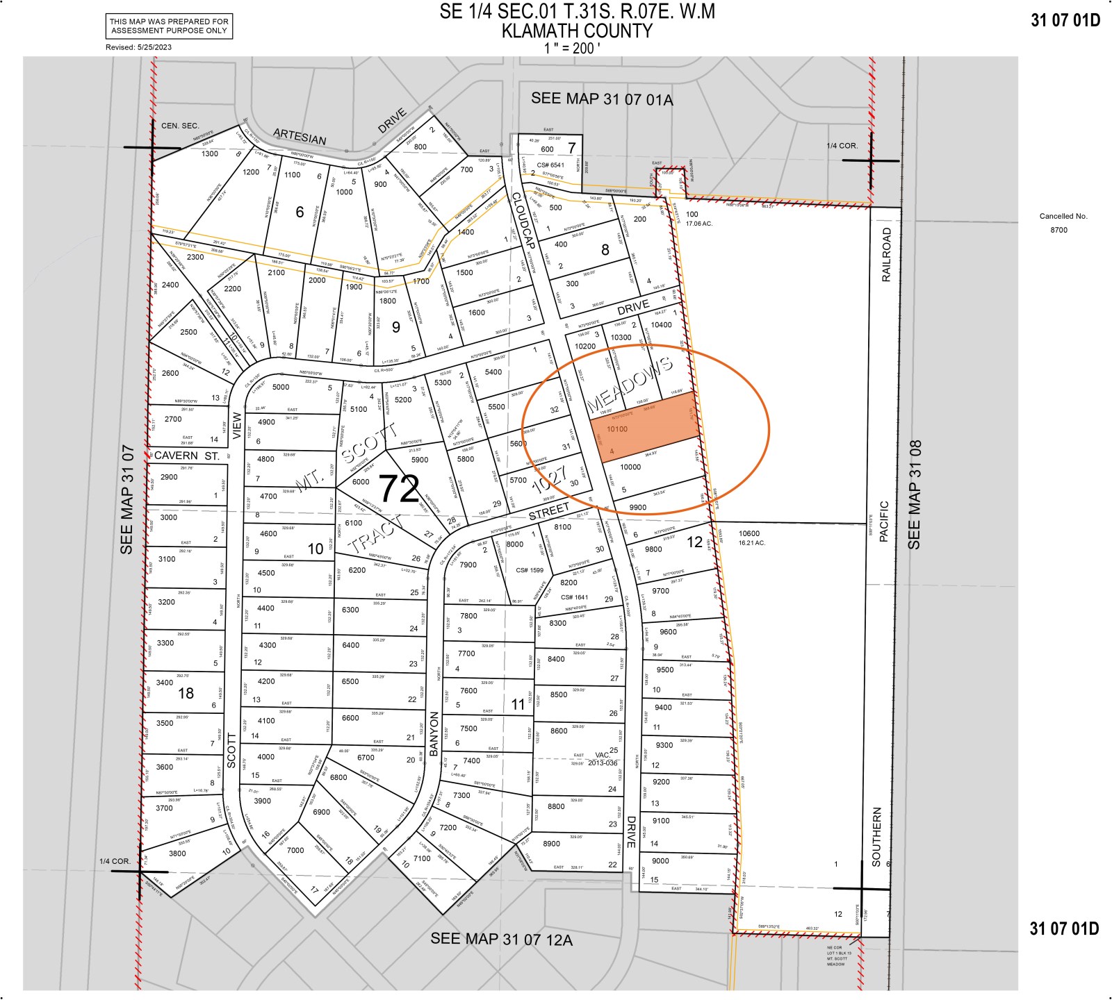
Klamath County, Oregon
Lot Description
Cash Price: $20,000
Terms Offered: 20% Down Payment of $4,000, 9.9% Interest Rate, $400 Monthly Payment, 48 Month Term
Location & Size
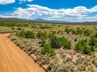
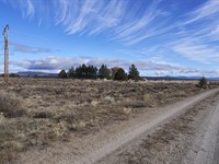
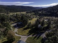
The subject property is a 1.34 acre lot located just off US Highway 97 in Mt. Scott Meadow, a rural residential community situated twenty miles north of Chiloquin.
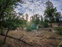
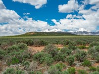
Perfect for a fishing cabin, mountain retreat or just seasonal vacations, this subdivision sits in close proximity to a number of expansive public lands including Klamath Marsh, the Scott Creek Campground and Diamond Lake. In addition, it is only a short drive to one of the most photographed and iconic attractions in the state, Crater Lake National Park.
County, State: Klamath County, Oregon
Lot Size: 1.34 Acres
Nearest Town: Klamath Falls
Street Address: Not Designated
Zip Code: 97624
Latitude & Longitude:
Center: 42.91230,-121.82190
Nw: 42.91230,-121.82270
Ne: 42.91260,-121.82130
Sw: 42.91190,-121.82250
Se: 42.91220,-121.82120
Legal Information
Legal Description: Mt Scott Meadow, Block 12, Lot 4
Parcel Number: 3107-001D0-10100
Account Number: R81128
Annual Taxes: $82.00
Access & Utilities
Roads & Access: The subject property is located just two blocks east of US Highway 97 along Cloudcap Drive, a well-maintained gravel and cinder road. Because of this, anyone visiting the property will have very little unpaved roadway to traverse meaning the land should be easily accessible in any vehicle type.
Power & Utilities: Unlike other rural subdivisions in Klamath County, utilities have a greater presence in the Mt. Scott Meadow community. This includes residential power lines which run along all the roads and touch the boundaries of all the parcels. In addition, there are underground utilities at the entrance of the subdivision which appear to be available for easy connection to anyone looking to develop a home site out here. Anyone looking to investigate the costs associated with getting service connected on the subject property is encouraged to contact Pacific Power, the utility company servicing this region.
Wells & Water Table Depth: The Mt. Scott Meadow subdivision is known to have an easily accessible water table with a number of wells drilled throughout this small community. Given its close proximity to the Klamath Marsh and National Wildlife Refuge as well as the myriad lakes, rivers and creeks which flow through this area, it would suggest that installing a well on the property should be neither difficult nor expensive. As always, prospective buyers are encouraged to speak with well drillers local to the region, as they will have far greater insight into this topic as well as a more accurate sense of cost and logistics.
Wells & Water Table Depth, Cont'd: In addition to the many bodies of water in close proximity of the subdivision, it's worth noting that Scott Creek runs along the eastern boundary of the subject property, further suggesting that accessing the water table may not be as expensive as in other rural subdivisions.
Legal Access: Yes
Access Road: Cloudcap Drive
Access Condition: Well-Maintained Gravel/Cinder Road
Access Frontage: 160 Feet (Western Boundary)
Power: At The Lot Line
Phone: Underground Utilities In The Area
Water: By Well or Holding Tank
Sewer: Septic/Alternative
Zoning & Restrictions
Zoning: The Mt. Scott Meadow subdivision is zoned R-2, a designation whose purpose is to establish and maintain areas for rural residential uses. This may include everything from single family residences to small-scale hobby farming. To learn more about the R-2 Zoning Designation, please see the attached Pdf.
No Hoa: The Mt. Scott Meadow subdivision has no HOA and there are no annual dues associated with land ownership here.
Covenants, Conditions & Restrictions: When the Mt. Scott Meadow subdivision was first created the developer drew up a set of covenants and restrictions to run with the land. While most of these are what we like to refer to as “reasonable, good neighbor restrictions” dealing primarily with the disposal of trash and prohibitions on excess noise, there are a few covenants that deal with acceptable structures or use of the land. That said, most of this document defers its authority to local and state zoning regulations and building codes. Because of this it is more important for a property owner here to familiarize themselves with those rules. Nonetheless, anyone considering purchasing the property who is curious to read them, may do so by reviewing the Mt. Scott Meadow Covenants and Restrictions document linked here.
Acceptable Structures: It should be noted that per County zoning, acceptable structures for this region include single family residences, mobile homes and manufactured homes. Additionally, the minimum square footage requirement for this region is only 500 square feet, meaning this area is ideal for tiny homes as well. To learn more about developing the land for residential purposes please contact the Klamath County Planning Department.
Camping & RV Use: The subject property may be used for camping but only for twenty-one days in a six-month period. Anyone looking to stay longer than seven consecutive days must acquire a permit from the County. Additionally, RVs may be used here but only for recreational purposes. RVs may not be used as permanent residences though may be used for longer if the owner has acquired a building permit (meaning if they're in the process of building the permanent home site). Tiny homes with a trailer frame (meaning not on a permanent foundation) are classified as RVs and thus must be registered with the state Dmv. Any use of such a vehicle on the land would be considered recreational use and not residential. To learn more about using the land recreationally please contact the Klamath County Planning Department.
Zoning: R-2 Rural Residential
HOA: None
Covenants, Conditions & Restrictions: Yes
Annual Dues: None
Time Limit On Building: None
Title Info
Title: Free & Clear
Liens and Encumbrances: None
Mineral Rights: None
Recent Survey: None
Title Insurance: Yes - Insured Through AmeriTitle
Conveyance Document: Warranty Deed
Suggested Type Of Closing: Title/Escrow
Doc Prep Fee: Waived
Misc
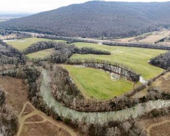
Scott Creek: As noted earlier, a branch of Scott Creek runs along the eastern boundary of the subject property and separates the parcel, as well as the entire Mt. Scott Meadow subdivision, from the private land to its east.
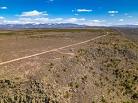
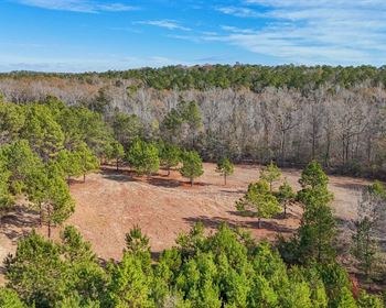
Topography: While mostly level, the subject property does boast a dense tree cover consisting primarily of lodgepole and ponderosa pines. Because of this, anyone looking to develop the land will need to spend some amount of money and time clearing the property before even a vehicle can be parked on it.
Outdoor Attractions: It's worth noting that the subject property sits within close proximity of so many enviable outdoor attractions your family can spend an entire summer exploring and not experience them all. While this is covered in greater details in the Towns & Attractions part of this listing page, we'd be remiss if we didn't mention that this list includes two National Forests (Umpqua and Willamette), the Klamath Marsh National Wildlife Refuge, Diamond Lake, Upper Klamath Lake, Lake of the Woods, Lost Creek Lake as well as one of the most iconic National Parks in the country, Crater Lake. Furthermore, Crater Lake boasts its own myriad of attractions in the form of campgrounds, hiking trails, overlooks and waterfalls. And everything mentioned here are just the attractions within thirty minutes of the subject property.
Nearby Towns
Chemult: 22 miles (24 min)
Chiloquin: 24 miles (27 min)
Crescent: 40 miles (41 min)
Klamath Falls: 50 miles (55 min)
Bend: 88 miles (1 hr 28 min)
Eugene: 123 miles (2 h 10 min)
Nearby Attractions
Crater Lake National Park
Diamond Lake
Umpqua National Forest
Willamette National Forest
Klamath Marsh National Wildlife Refuge
Lake of the Woods
Lost Creek Lake
Discover Klamath
Fremont-Winema National Forest
Klamath Basin National Wildlife Refuge
Sprague River
Lot Maps & Attachments
More Lot Details
More Lots from William Hemingway
 10.7 AC : $35K
- 5.8 AC : $18K
- 1.1 AC : $30K
- 2.5 AC : $12K
- 1.7 AC : $14K
- 2 AC : $12K
- 1.4 AC : $15K
- 5.1 AC : $12K
- 0.5 AC
- 0.3 AC
- 0.2 AC : $15K
- 0.2 AC : $20K


