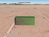
Own 1 Acre in Torrance County, NM
W Placitas Rd : Moriarty, NM 87035
Torrance County, New Mexico
Lot Description
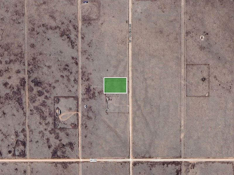
Claim your own piece of New Mexico with this 1-acre parcel in the Estancia Ranchettes subdivision, just outside the town of Moriarty. This property combines tranquility with accessibility, offering dirt road access, expansive views, and close proximity to some of the region's top cultural and outdoor attractions. Whether you want a weekend escape, a future homesite, or a smart land investment, this lot places you right in the heart of Torrance County's beautiful high desert.
Only 13 minutes from downtown Moriarty and just over an hour from Santa Fe, you'll have convenient access to shopping, dining, and everyday needs. For recreation, enjoy nearby destinations such as Wildlife West Nature Park or the U.S. Southwest Soaring Museum-perfect for outdoor enthusiasts and families alike.
Property Highlights:
Peaceful 1-acre lot in Estancia Ranchettes subdivision
Zoned Residential - single-family, mobile, or modular homes allowed
Nearby utilities and services make future development easier
Great spot for a getaway, retirement home, or long-term investment
Peaceful setting near Moriarty with easy access to Santa Fe and Albuquerque
Easy dirt road access with open skies and wide views.
Don't Miss Out on This Amazing Opportunity.
VISIT The Property Today: This property is undeveloped and may not have visible signage, but it's easy to find using the GPS coordinates (34.99559, -105.90252)
Cash Price: $4,700
Seller Financing Available. Contact us for more info.
Property Details:
Parcel : R020484
Property Address: W Placitas Rd, Moriarty, NM 87035
County: Torrance County
State: New Mexico
Parcel Size: 1 acre
Subdivision: Estancia Ranchettes
Lot Number: 5 | Block: 7 | Unit: 14-A
Legal Description: Subd: Estancia Ranchettes Lot: 5 Block: 7 Unit: 14-A
Property Type: Vacant
Elevation: 6,335.3 feet
GPS Center Coordinates: 34.99559, -105.90252
Gps Coordinates (Corners):
34.9959, -105.9028
34.9959, -105.9023
34.9953, -105.9023
34.9953, -105.9028
Tax Amount: $8.60
Securing your property is easy with us. We use a trusted third-party title company to ensure a clear title and a smooth transaction. Contact us today via message or phone to get started.
The buyer is responsible for verifying all information with the County as to what can and cannot be done with the property. The buyer will need to work with the County to obtain the proper permits if needed. The buyer will also need to confirm the availability of any utilities needed or serviced on the property. Seller makes no warranties or representations about the land, its condition, or what can be built on the property.
More Lot Details
More Lots from Lisa Foreman
 0.2 AC : $22.5K
- 0.5 AC : $16.6K
- 0.4 AC : $16.6K
- 0.8 AC : $143K
- 7 AC : $49.9K
- 1 AC : $7.2K
- 1 AC : $80.7K
- 1.3 AC : $52K
- 5 AC : $71.7K
- New0.3 AC : $3.5K
- 2 AC : $129K
- 1 AC : $6.5K