20Ac Hudspeth TX 69641 227/Mo
Unnamed Road : Sierra Blanca, TX 79839
Hudspeth County, Texas
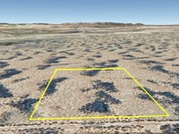
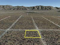
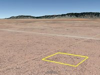
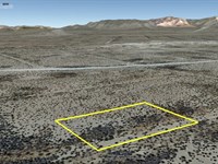
Lot Description
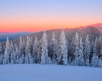
Calling all outdoor enthusiasts-this wide-open 20-acre property in Hudspeth County is your chance to own real freedom for just $227/Month. With endless desert views, fresh air, and room to roam, it's perfect for camping, hiking, off-roading, stargazing, or setting up your own off-grid basecamp. No crowds, no noise-just space to explore, relax, and reconnect with the outdoors whenever adventure calls.
Pricing option:
Cash Price: $20,000
Owner Finance: $21,000 - $300 doc fee/$0 down & 105 payments of $227.03
($200 Loan Payment, $10.00 Service Fee, $17.03 property tax)
• No credit check • No interest • No prepayment penalties
Note: Down Payment & Doc Fee can be paid using credit or debit card. Monthly payments must be paid using ACH - checking account/routing number from a bank in the United States.
Property details:
Acres: 20
Property ID: 69641
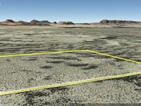
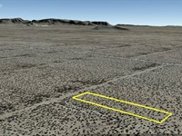
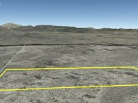
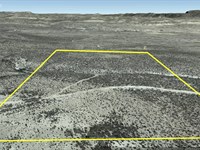
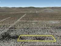
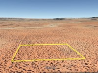
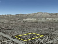
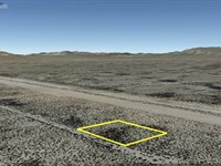
Legal Description: Tract(s) 21, Section 21, Block 38 Unit 529, Survey PSL TWP (if applicable) N/A, Hudspeth County, Texas. A total of: 20 acres.
Surveyor's Description: Surveyor's Description 20 Acres Hudspeth 69641
Elevation: 4,678 ft
Topography: flat
Roads: dirt
HOA/POA: none
Utilities: none
This is off-grid land. There are no city utilities here. You can use batteries, a generator, solar panels, or a windmill for electricity.
For water you can bring it with you, drill a well, have water trucked in and delivered, set up a rain catchment system
State: Texas
County: Hudspeth
Property Tax: $204.26 yr.
A phone app such as Land Glide or OnX Hunt can be used to find parcel lines and corners while walking the property (if using OnX Hunt be sure to add the “TX Private Lands” map layer to see the parcel lines).
GPS Coordinates:
NorthWest Corner: 31.360089°, -105.244104°
Southwest Corner: 31.356546°, -105.244379°
Southeast Corner: 31.356546°, -105.242207°
Northeast Corner: 31.360102°, -105.242040°
Ready to make this property yours? Have questions? Contact us today to start your journey to land ownership in beautiful West Texas.
Lot Maps & Attachments
More Lot Details
More Lots from Billy Rogers
 New5.3 AC : $10.8K
- 0.4 AC : $3.7K
- 1 AC : $1.7K
- 0.5 AC : $3.2K
- New10.1 AC : $15.2K
- New0.2 AC : $2K
- New20 AC : $23.9K
- 19.8 AC : $23K
- New0.6 AC : $4.5K
- 11.4 AC : $11.2K
- 0.5 AC : $4K
- 0.5 AC : $3.2K