Scenic Escape, Only $609.67 Down
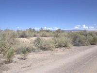
Oak Dr & 21st St : Dolan Springs, AZ 86441
Mohave County, Arizona
Lot Description
$609.67 Down $609.67/Mo for 24 Months 0% Int
No Credit Checks. All Major Credit Cards Are Accepted.
Call or Text Us Now To Reserve.
30-Day Money Back Guaranteed.
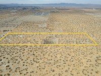
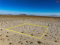
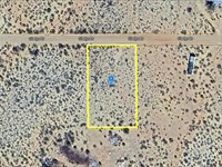
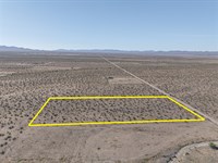
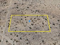
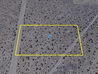
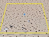
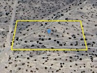
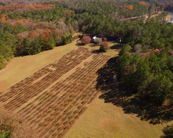
Discover this 1.05-Acre parcel in Dolan Springs, Mohave County, AZ. Situated northeast of Mt. Tipton and not far from Red Lake, this lot places you within reach of outdoor adventures and scenic Arizona landscapes. It's also conveniently located near Highway 93, offering easy access to Kingman, Lake Mead, and even Las Vegas for weekend getaways or errands. This is a great space to create your own retreat while staying connected to nearby towns and recreation.
Property Location: Dolan Springs, AZ 86441
Lot Size: 1.05 Acres
Zoning: Residential and Agricultural Use
Electricity: YES - Power Lines are There
Primary Road: Dirt Road Access
Water: Would be from Alternative Sources
Make Your Move, Reserve It Now For Only $609.67. Act Now On This Sought-After Lot While You Can. Get Easy 24 Months Financing at 0% Interest, No Credit Checks, All Major Credit Cards Are Accepted.
$609.67 Down $609.67/Mo for 24 Months 0% Int
Call or Text Us Now To Reserve.
Cheap and Affordable Vacant Land For Sale in Dolan Springs
Flexible Financing Options are Available
Owner Financed Rural Land in Arizona
Undeveloped Property For Sale With Direct Road Access
For Residential and Agricultural Development in Mohave County
Buildable Land With Power Access
Desert Land With Mountain Views
Finance Land Near Entertainment Hubs
Farm and Ranch Land Ideal For Farming and Harvesting Crops, Grazing Livestock
Perfect for Hiking, Hunting, and Fishing Enthusiasts, Being Close to Recreational Areas
Quiet and Friendly Neighborhood
Located Near Golf Course, Schools, Parks, Shops, and Restaurants
Not in Flood Zone and Wetlands
Property Within Secured Subdivision
Lot Maps & Attachments
Directions to Lot
Center of Lot, GPS Coordinates: 35.662628, -114.223389
GPS Coordinates for Corners of the Property:
Nw: 35.662860, -114.223845
Ne: 35.662859, -114.222937
Se: 35.662400, -114.222935
Sw: 35.662400, -114.223842
More Lot Details
More Lots from Patrick Elder
 0.2 AC : $6K
- 3.8 AC : $70K
- 5 AC : $60K
- New3.1 AC : $300K
- 10 AC : $33K
- 2.3 AC : $29K
- 1 AC : $20K
- 5 AC : $28K
- 1 AC : $14.5K
- 1.1 AC : $12K
- 2.5 AC : $23K
- 1 AC : $11K