Owner Financed Land
Sanders, AZ 86512
Apache County, Arizona
Lot Description
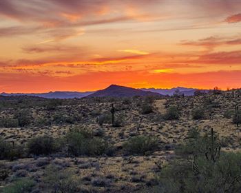
Apache County is a naturally beautiful area in northeastern Arizona, with great natural resources.
The area offers great weather, a clean and healthy rural lifestyle, affordable property, and access to a wide range of outdoor recreational adventures.
You can choose to RV or camp on your land, for as long as you like, as you hold it for investment. You can also build your dream off grid home if thats what you choose to do. This can be your off grid homestead. You can get back to nature on your terms.
St. Johns, the county seat, offers all of the high quality facilities you could ask for.
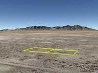
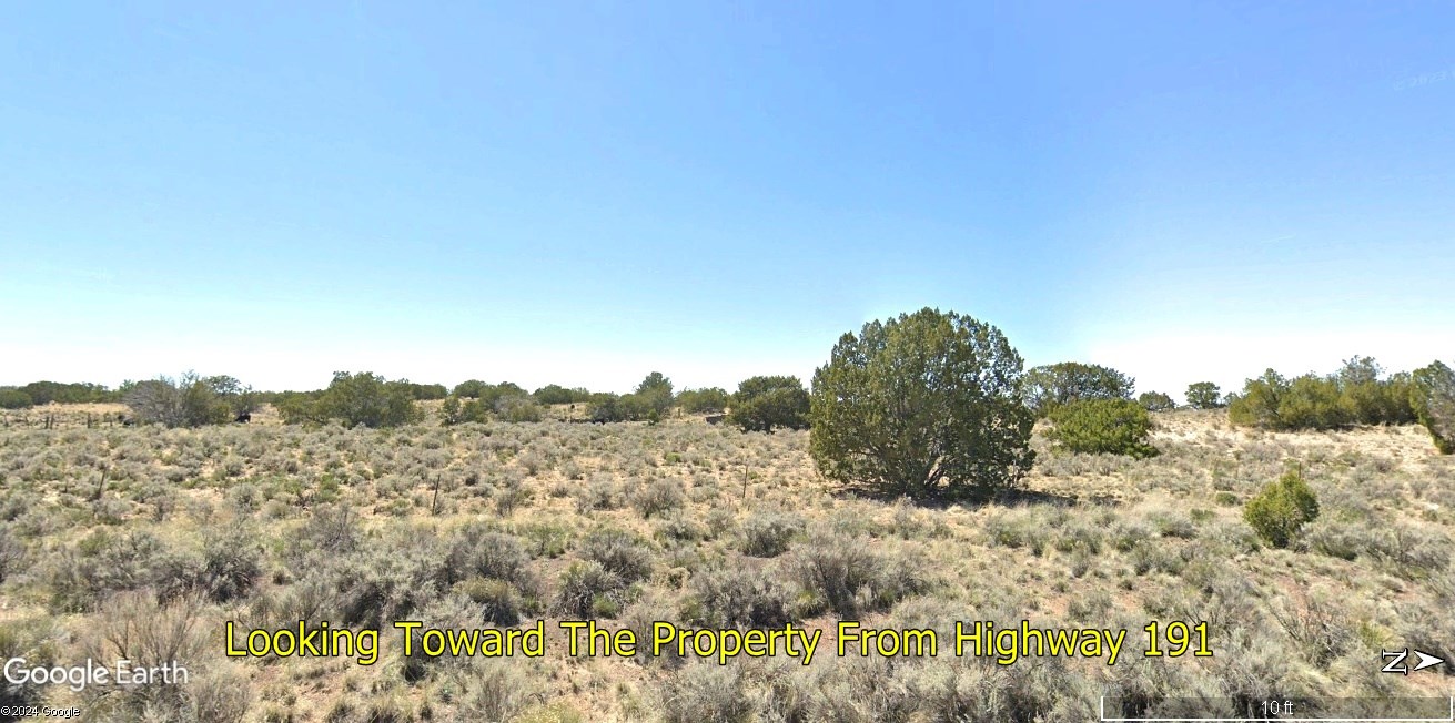
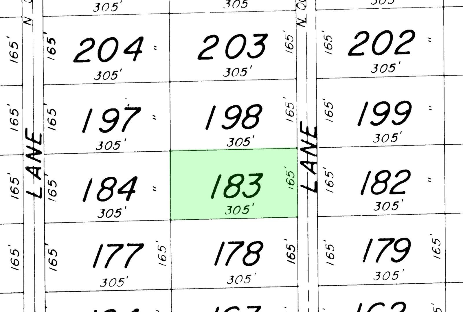
White Mountain Shadows is an undeveloped subdivision in Apache County, Arizona. This beautiful approximately 1.16 acre property is mostly meadow with scattered pinion. The east side of the lot runs along platted Camina Lane, which connects with County Road 7396. This platted dedicated easement gives legal access, so there are no worries about being landlocked. Taxes are less than $5 per year. Interstate 40 is 3 1/2 miles to the north, while US Highway 91 is about 3 miles to the east. Chambers is 3 1/2 miles to the northwest, and Sanders is around 5 miles to the northeast. Holbrook is approximately 47 miles away.
Apache County is tiny house friendly. They have a progressive tiny house building code, and are reputed to be reasonably flexible. Only about 13% of the land in Apache County is privately owned. The rest is Native American land and publicly owned land. This property is zoned agricultural, please call the county planning and zoning department at with any land usage questions.
There are no property owners association, home owners association, or subdivision restrictions.
This property gives you driving-distance access to incredible wonders of nature and cultural history. Petrified Forest National Park is to the west. The county seat of St Johns is to the south, where you will find Lyman Lake State Park, the Apache County Museum, the Casa Malpais Archaeological Park, Sunrise Ski Resort, and much more. The Cibola National Forest is to the east. Within an easy drive are Apache-Sitgreaves National Forest, the Navajo Nation Museum, and Springerville Heritage Center. Within a couple hours' drive are the Grand Canyon, Canyon De Chelly National Monument, Wheatfields Lake, Hope Arch, the North Rim Drive, Spider Rock, the South Rim Drive, Canyon del Muerto, and the Monument Valley Navajo Tribal Park. You will want to visit the storied R.B. Burnham & Company Trading Post in Sanders.
Wildflowers are everywhere, while pronghorn and elk inhabit the region. This is a nice quiet area, with ranching being the main activity. There are water wells scattered through the area, and if you want to explore that option then you would need to consult a local well driller and/or contact the helpful people at the Arizona Department Of Water Resources. Water can also be hauled in from Sanders. Verizon cell phone reception was great when we were in the area. Electricity is about 350 yards away, although given the clear sunny days in Arizona you will probably be interested in solar power.
Elevation gradually goes up 10 feet across the 305 feet width of the property, as is typical. There is a nice decoration of juniper trees.
Everyone qualifies for the same financing. We do not run credit checks.
With an initial payment of $294 we will finance the balance for as little as $105.92 per month over 6 years. Or you can choose to buy the property outright instead of financing, and receive a 10% cash discount.
For more information or to purchase, please click on the green Land Website button below.
Lot Maps & Attachments
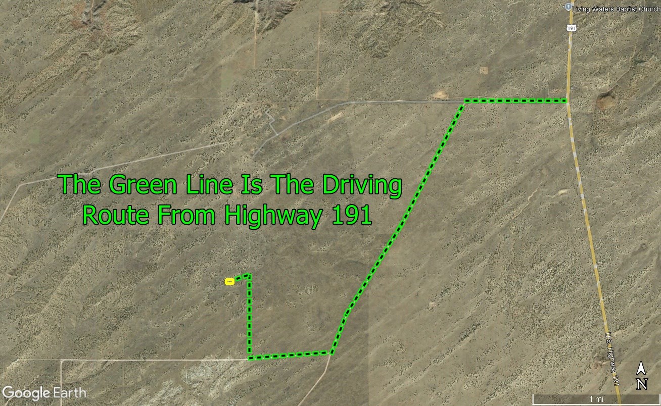
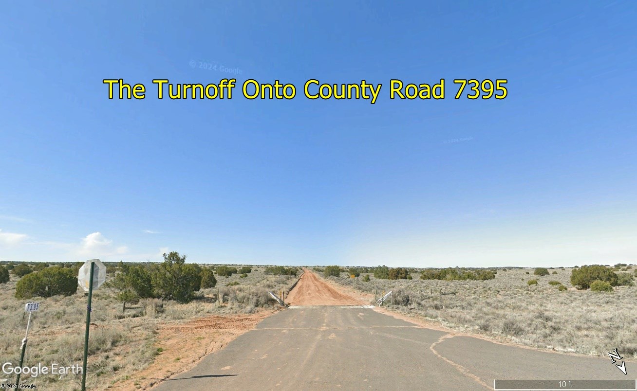
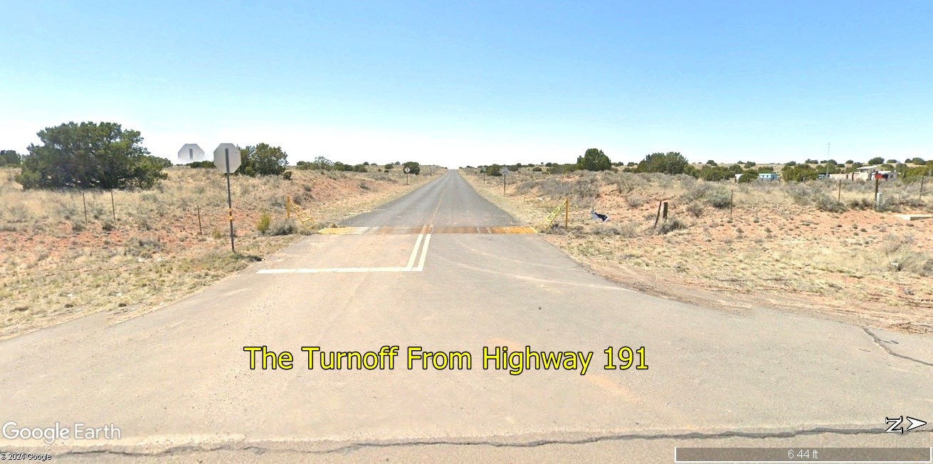
Directions to Lot
From Flagstaff, AZ go east on Interstate 40 for 140 miles.
Take Exit 339 for US-191 S toward St Johns.
0.2 mile later turn right onto US-191 S.
3.2 miles later turn right onto Sand Springs Drive at 35.169764 -109.338344.
0.8 mile later turn left onto County Road 7395 at 35.169711 -109.352672.
2.2 miles later turn right onto County Road 7396 at 35.141236 -109.371372.
0.64 mile later turn right onto Arcadia Lane at 35.140367 -109.382692.
0.66 mile later make a sharp left turn onto the trail road at 35.149941 -109.382768.
0.14 mile later you will be at the property.
More Lot Details
More Lots from Samantha Stephens
 0.3 AC : $4K
- 1.2 AC : $9K
- 0.3 AC : $3K
- 7.5 AC : $12K
- 1 AC : $4K
- 5 AC : $30K
- 0.3 AC : $7K
- 10 AC : $20K
- 1.8 AC : $7K
- 7.5 AC : $12K
- 10 AC : $40K
- 0.8 AC : $9K


