Land with Easy Terms $149 Down
Sanders Unified District : Sanders, AZ 86512
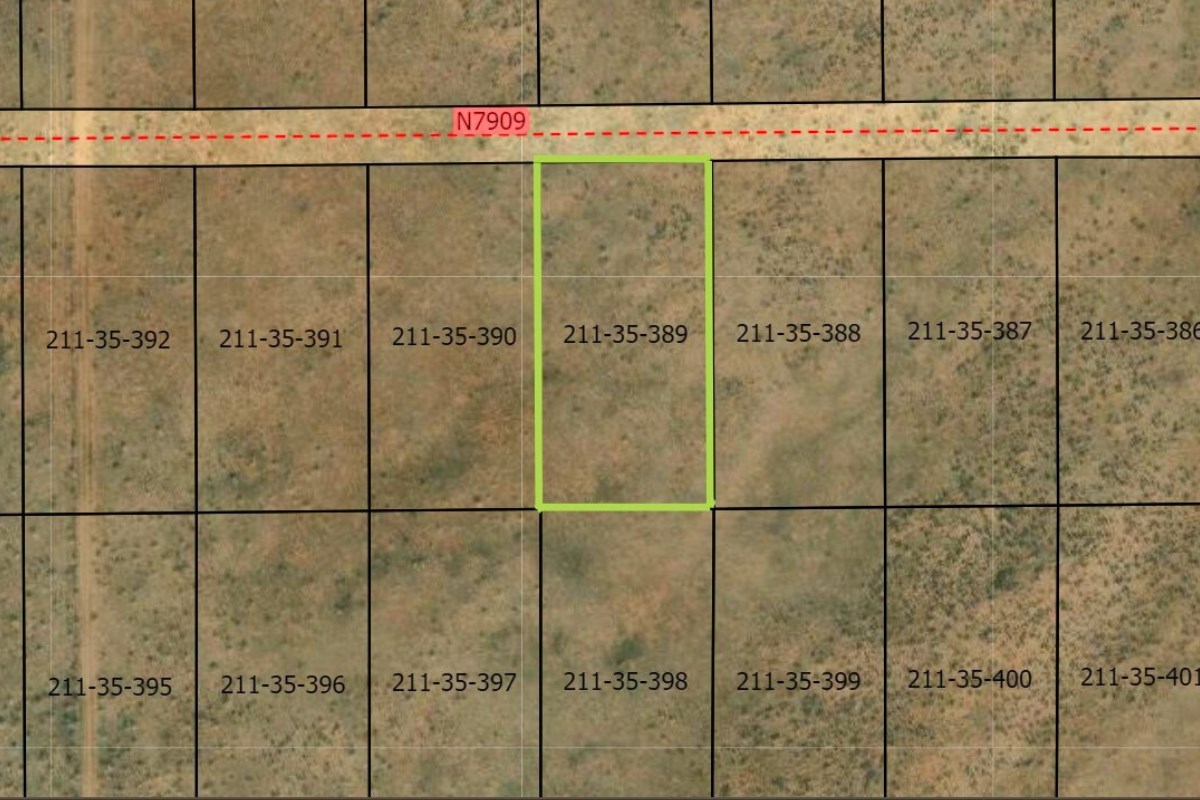
Apache County, Arizona
Lot Description
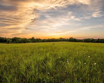
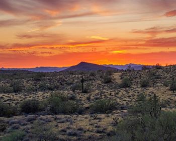
Your Arizona Dream Starts at Bell Brand Ranches.
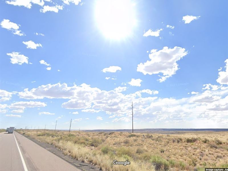
Get ready to chase your wildest dreams on this rugged 1-acre treasure nestled in the heart of Bell Brand Ranches, Arizona. This desert beauty is bursting with natural charm, open skies, and endless potential. Got big ideas? Good news-the neighboring acre is up for grabs too, giving you double the space to spread out, build, or just soak up the views. With welcoming small towns nearby and that crisp, clean desert air, this is more than land-it's your canvas for adventure.
Bell Brand Ranches isn't just a place-it's a lifestyle. Whether you're into off-grid living, want to park a mobile setup, or dream of creating a rustic getaway, this land is your launchpad. No gunfights here-just peaceful sunsets, wide-open spaces, and opportunities as far as the eye can see. With friendly neighbors and room to breathe, you can finally unplug and settle into something real.
So, what are you waiting for? This is Arizona gold-sunny skies, starry nights, and freedom under your boots. Don't let this one gallop away. Cowboy up, claim your acre (or two), and let the next great chapter of your life begin at Bell Brand Ranches.
Location: Sanders, Az
Size (Acres): 1.04
Zoning: Ag-Agricultural: 0013 - Res Rural Subdivided
Terrain: Desert
Access: Gravel Road
Nearby Cities: Flagstaff, AZ (2 hr 48 min, 115 miles), Winslow, AZ (56 min, 57.1 miles), Show Low, AZ (1 hr 20 min, 72.2 miles), Holbrook, AZ (29 min, 25.1 miles), Joseph City, AZ (38 min, 35.4 miles)
Nearby Attractions: Petrified Forest national Park, Puerco Pueblo, The Tepees, Painted Desert Inn, Dinos of Holbrook
Nearest highway: US Highway 191 & 7156 Adamana Rd
Utilities:
Power: Nearby street.
Water Well: You install.
Sewer Septic: You install.
What can be built on the property? The minimum lot/parcel size in Apache County is one (1) acre when the dwelling is connected to a septic system and not less than net 10,000 square feet when connected to a public sewer. Contact Building Safety.
Time Limit to build? Begins when a building permit is issued. Contact Apache County Building Safety.
Is Camping Allowed? Up to 30-consecutive days per quarter. Not allowed in Greer, Az
Camping restrictions if any. Up to 30-consecutive days per quarter. Not allowed in Greer, Az
Are RV's allowed? Yes. Not allowed in Greer, Az
Rv Restrictions if any. Used as a permanent dwelling, connected to septic or public sewer. Not allowed in Greer, Az
Are mobile homes allowed? Mobile Homes (Prior to 1976) are prohibited.
Mobile home restrictions if any. Manufactured homes (after 1976), restricted to 15-years or newer. Not allowed in Greer, Az
Is property part of an HOA or Poa? Contact the Recorder's office.
HOA or POA dues if any: Contact HOA or Poa
Subdivision Cc&R availability: Contact the Recorder's office
Owner Financing Made Easy - Land Ownership Starts Now.
- Low Down Payment
- Easy Monthly Payments
- Zero % Interest
- No Credit Checks Needed
- Cash Discount Available
- 90-Day Satisfaction Guarantee
Why wait for your dream property? Own land today-stress-free and affordable. Interested? Contact us NOW before it's gone.
Important Notes:
- All of the information we have about this Property is contained on our Website Property Page.
- We ask that buyers do their own Due Diligence.
- You can visit any of our properties at any Time. GPS Co-ordinates and Driving Directions Given.
- Please call the Applicable County offices for any Specific Questions about the Property.
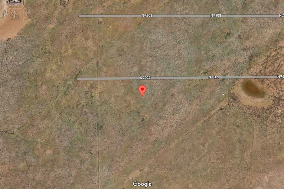
Lot Maps & Attachments
Directions to Lot
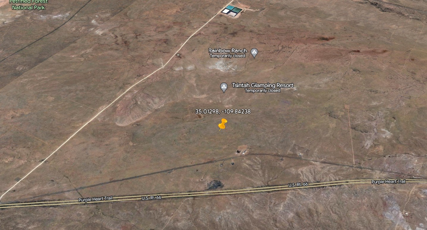
Gps: 35.01298, -109.84238
Gps Nw: 35°00'48.2"N, 109°50'33.5"W
Gps Ne: 35°00'48.2"N, 109°50'31.8"W
Gps Sw: 35°00'45.3"N, 109°50'33.5"W
Gps Se: 35°00'45.2"N, 109°50'31.7"W
Direction from Tucson, AZ
1. Get on I-40 W in Navajo County from 7156/Adamana Rd and Old Rte 66 (13 min, 7.8 mi)
2. Follow AZ-77 S, US-60 W and AZ-77 S to N Oracle Rd in Tucson (4 hr 31 min, 250 mi)
3. Continue on N Oracle Rd. Drive to W Jacinto St (2 min, 0.7 mi)
Directions from Sierra Vista, AZ
1. Get on I-40 W in Navajo County from 7156/Adamana Rd and Old Rte 66 (13 min, 7.8 mi)
2. Take AZ-77 S, US-60 W, US-70 E and I-10 W to N Buffalo Soldier Trail in Cochise County (5 hr 40 min, 338 mi)
3. Continue on N Buffalo Soldier Trail. Take E Golf Links Rd to E Tiffany Pl in Sierra Vista (8 min, 4.3 mi)
Directions from Phoenix, AZ
1. Get on I-40 W in Navajo County from 7156/Adamana Rd and Old Rte 66 (13 min, 7.8 mi)
2. Continue on I-40 W to Holbrook (20 min, 19.7 mi)
3. Continue on AZ-377 S to Heber-Overgaard (40 min, 40.7 mi)
4. Follow AZ-260 W and AZ-87 to Washington St in Phoenix. Take exit 148 from I-10 E (2 hr 17 min, 140 mi)
5. Drive to Washington St (6 min, 2.0 mi)
Directions from Mesa, AZ
1. Get on I-40 W in Navajo County from 7156/Adamana Rd and Old Rte 66 (13 min, 7.8 mi)
2. Continue on I-40 W to Holbrook (20 min, 19.7 mi)
3. Continue on AZ-377 S to Heber-Overgaard (40 min, 40.7 mi)
4. Take AZ-87 to W Main St in Mesa (2 hr 11 min, 129 mi)
5. Turn left onto W Main St (1 min, 0.3 mi)
More Lot Details
More Lots from Kirk Peart
 0.2 AC : $19K
- 0.2 AC : $12K
- 0.5 AC : $24K
- 0.2 AC : $18K
- 0.9 AC : $39.8K
- 1.3 AC : $26K
- 0.3 AC : $14K
- New0.2 AC : $18K
- 0.3 AC : $14K
- 0.2 AC : $13K
- 0.3 AC : $14K
- 0.2 AC : $12K


