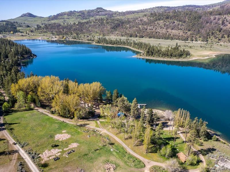
Wannacut Lake Resort
111 E Wannacut Lane : Oroville, WA 98844
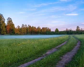
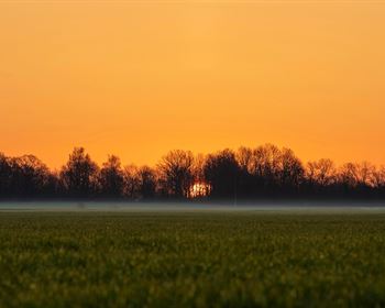
Okanogan County, Washington
Lot Description
Marketing Remarks
The Wannacut Lake Resort features 7 water front parcels with approximately 1150 feet of frontage on Wannacut Lake. There are 10 motel units, 3 bedroom cabin, 2 bedroom cabin & RV sites with full hook ups. There are also plenty of campsites available with a comfort station which has bathrooms with showers & laundry facilities available. All of the cabins and hotel units have amazing views of the lake.
Land
The Wannacut Lake Resort features 7 water front parcels with approximately 1150 feet of frontage on Wannacut Lake. There are 10 motel units, 3 bedroom cabin, 2 bedroom cabin & RV sites with full hook ups. There are also plenty of campsites available with a comfort station which has bathrooms with showers & laundry facilities available. All of the cabins and hotel units have amazing views of the lake. There is a store with those needed necessities for guests and lots of upgrades completed and ready to add a restaurant for onsite dining. Managers quarters have been remodeled above the store. Wannacut Lake is 428 acres and filled with Rainbow trout and Largemouth bass. The deep cold waters offers good fishing well into the summer months.
Recreation
Rainbow trout are easily one of the most popular fish to catch in Washington for many anglers.
If you agree, one place you might want to consider fishing is Wannacut Lake not far from the Canadian border in Okanogan County.
Wannacut Lake is deep, cold and nicely sized at more than 400 acres. And it's full of rainbow trout.
Anglers mostly come to chase after those trout, which the Washington Department of Fish and Wildlife stocks to the tune of about 50,000 young fish as well as a more modest number of legal- and jumbo-sized rainbows.
Altogether, those stocked trout make for some very good trout fishing at this seasonal lake.
WDFW also includes largemouth bass among the species you might catch here, and some sources have suggested there may be a few panfish as well.
But make no mistake, rainbow trout are the draw here.
Most rainbows in the lake are around pan-sized, though carryover trout to 14 inches and perhaps beyond will come to the net with enough regularity to make things interesting.
Water/Mineral Rights & Natural Resources
There is a Class A water system owned by and providing water to the resort and neighboring properties.
Region & Climate
Oroville lies in a climatic region that is typified by large seasonal temperature differences, with warm to hot summers and moderately cold winters. According to the K ppen climate classification system, Oroville has a humid continental climate, Dfb on climate maps
History
Oroville was first settled by European settlers in the late 1850S and known as rag town.' The settlement was named Oro, after the Spanish word for gold, in 1892 after the surrounding gold mines and in an attempt to attract prospectors and merchants. The Post Office objected to the name Oro because a town was already named Oso in Washington, so the name was changed to Oroville, in 1909. Oroville was a stop along the Spokane Falls and Northern Railway line from British Columbia to Spokane, via Molson and Chesaw. In 1914 a third branch south to Wenatchee was constructed to avoid the steep inclines on the original Spokane track
Passenger train service to Oroville was operated by the Great Northern Railway until July 14, 1953, with freight operations continuing later.
Oroville started to become a tourist location in the mid-2000s, large condo developments were proposed. The city had an economy peak in 2005-2007, but has continued suffering since to the great recession.' It is home to the Dorothy Scott Airport, an international municipal airport with U.S. Customs check, located two miles outside of the town center that was opened in August 1937.
Location
Oroville is located 4 miles 6.4 km south of the Canada-US border, and features an official crossing into Osoyoos, British Columbia. It is located at the south end of Osoyoos Lake, which empties into the Okanogan River on the east side of the town the town is bound to the west by the Similkameen River. U.S. Route 97 runs through Oroville.