Sangre DE Cristo Ranches with Trees
Pyne Road : Fort Garland, CO 81133
Costilla County, Colorado
Lot Description
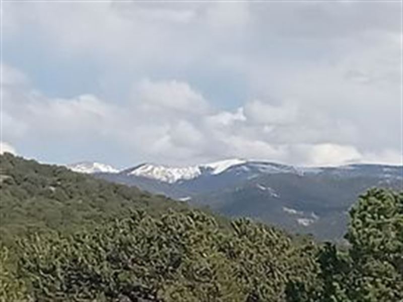
Looking for a beautiful property to build your dream cabin? Look no further. This 5 acre corner lot has amazing views of Mt. Blanca and the Sangre de Cristo Mountains. Great roads coming into and they stay well maintained all winter. With majestic mountain views and proximity to the town of Fort Garland, this is a perfect place to find new ideas for an easy living.
The Sangre de Cristo Ranches were developed in the heart of the Sangre de Cristo Mountain range, with Mt. Blanca at over 14,000 feet, highlighting the scenery. This area is highly sought after with tons of opportunity for activity. Your days will be as full as you want them to be. Spend hours hiking, hunting, fishing, and watching nature during the day.
What are you waiting for? Call us now to learn more about this down (plus one time doc fee) then, for 60 months (prorated taxes and monthly note fee are in addition)
Click The Orange "Contact Owner" Button To Contact Us About This Property Today.
Property Details:
Parcel: 70236581
Property address: Fort Garland, CO 81133
Subdivision: Sangre DE Cristo Ranches
County: Costilla County
State: Colorado
Parcel Size: 5.007 Acres
Legal Description: S.D.C.R. Unit J-2 BLK 217 Lot 4580 Cont. 5.007 Ac
Land Use: Residential Acreage
Property Type: Vacant
Zoning: Site built home 600sqft min, manufactured homes are acceptable. Camp for 14 days (every 3 months); long term camping/rv permit available (60 days - with up to 3 renewals, fee - septic & water required); Temporary RV Occupancy permit available ( fee - good for 90 days at a time while building, renew for up to 18 months). Please contact Costilla County Planning & Zoning for additional information.
Gps Center Coordinates: 37°28'49.81"N, 105°18'53.75"W
Gps Coordinates (Corners):
Gps Nw: 37°28'52.92"N, 105°18'58.04"W
Gps Ne: 37°28'49.58"N, 105°18'49.24"W
Gps Se: 37°28'48.21"N, 105°18'49.81"W
Gps Sw: 37°28'47.75"N, 105°18'55.22"W
Elevation: 8628 feet
Tax Amount: 2