Lot in Sedona, Az, Red Rock Views
234 Eagle Dancer Road : Sedona, AZ 86336
Yavapai County, Arizona
Lot Description
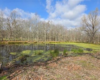
1 Acre of Land for Sale in Sedona, Arizona with Mature Trees and Amazing Views of the surrounding Red Rocks and Mountains. This parcel borders the Coconino National Forest along the Western Boundary.
Call or Text anytime for questions or to purchase this property. Please reference the Property ID: Az_Yavapai_00002
Rarely does the opportunity come, to make such a breathtaking location your home.
Let us take you to a place where the best of both Worlds creates a sanctuary of solitude just minutes from all the modern amenities you need.
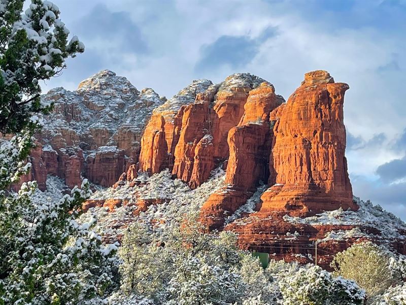
1 Acre +/- lot with breathtaking views of Wilson Mountain, Thunder Mountain, Sugarloaf Mountain and Coffee Pot Rock.
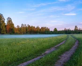
This incredible future homesite is situated behind a private gate along the paved Eagle Dancer Road, that ends just East of the property.
Private & Secluded, while still being conveniently located, this property is approximately 1.6 miles from the intersection of State Route 89A and the renowned Soldiers Pass Road.
This easy access enables you to reach Whole Foods, Chase Bank, Dining and Shopping; without even hitting a stop light.
This amazing lot borders the Coconino National Forest along the West boundary and there is a discrete trailhead just a few minutes walk away.
There is 322 feet of frontage on Eagle Dancer Road along the southern boundary of the property. State Highway 89A is only 1.6 miles from the property and leads to the cities of Cottonwood, Flagstaff, and Prescott, AZ as well as Slide Rock State Park.
This property is zoned Rs-35 (Residential).
Property Specifications
Parcel Size: 1 Acre M/L
Property ID: Az_Yavapai_00002
Elevation: 4,600 feet
HOA Fee: None
Apn: 408-22-104M
Title: Free & Clear
Conveyance: Warranty Deed
Electric provided by Arizona Public Service
Natural Gas provided by Unisource Services Natural Gas
Water provided by Arizona Water Company
Internet provided by Centurylink or Suddenlink
Waste Removal provided by Patriot Disposal, Taylor Waste, or Waste Management
Approximate Distance to Nearby Cities & Points of Interest
Property is within Sedona, AZ city limits : Population 10,000
Property borders Coconino National Forest
20 minutes to Red Rock State Park
21 minutes to Village of Oak Creek, AZ : Population 6,130
21 minutes to Slide Rock State Park
27 minutes to Cottonwood, AZ : Population 12,000
33 minutes to Tuzigoot National Monument
35 minutes to Dead Horse Ranch State Park
40 minutes to Montezuma Castle National Monument
54 minutes to Flagstaff, Arizona : Population 139,000
1 hour 2 minutes to Walnut Canyon National Monument
1 hour 32 minutes to Prescott, Arizona : Population 46,000
2 hours 4 minutes to Phoenix, Arizona : Population 1,680,000
2 hours 5 minutes to Grand Canyon National Park
GPS Coordinates
Northeast Corner: 34.876525, -111.790424
Southeast Corner: 34.875949, -111.789992
Center Point: 34.876148, -111.790424
Contact Information
We are grateful to partner with Arizona Real Estate Brokers Dennis & Janie Tribble, Co-Owners of Redstone Sedona Properties, on the sale of parcel.
For questions or to purchase this incredible property, please contact Dennis & Janie.
Please reference the Property ID: Az_Yavapai_00002
To speak with , please Call or Text us anytime.
Call or Text anytime for questions or to purchase this property. Please reference the Property ID: Az_Yavapai_00002