10 Acre Nevada Ranch
Montello, NV 89830
Elko County, Nevada
Lot Description
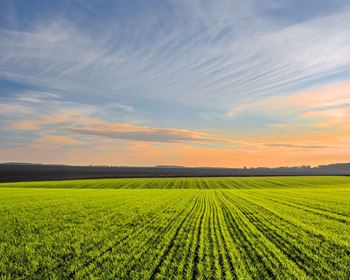
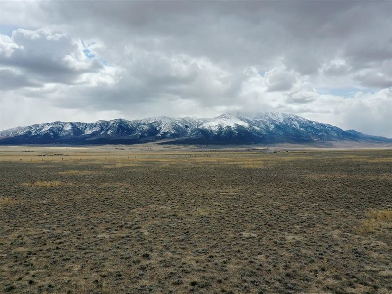
Wow, this is a beautiful property south of Montello, Nevada. It is in the Pilot Valley and has small mountains to the East and West of the property. The Pilot Valley has power running throughout with small homesteads scattered around the valley. There is an aquifer with good water that runs below the valley. The property is about 8.5 miles off Highway 233. You travel for about 7 miles on Pilot Road which is well graded and easily traveled by any type of vehicle. The last 1.5 miles are on Canon road. The property is covered with prairie grass and sagebrush. There is excellent cell reception throughout the Pilot Valley due to a large cell tower about 1.5 miles off Hwy 233 on Pilot Road. In the Pilot Valley I have seen Antelope, Hawks, Ground Squirrels, and Rabbits. This would be a great property to homestead or for a get away with easy access to water and power. There is a fence on the east side of the property.
Doc Fee NV 0 hrs. 22 min 14.1 Miles
Salt Lake City UT 2 hrs. 27 min 156 Miles
Elko City NV 1 hrs. 46 min 105 Miles
Twin Falls ID 2 hrs. 50 min 169 Miles
Property Information
Size (Acres): 10.0
Apn:
Legal Description: Township 38 North, Range 69 East, M.D.B.&M. Section 33: Ne4ne4nw4
Deed Type: Warranty
Subdivision: Gamble District
Gps: 41.1377854358091, -114.169724316378
County: Elko County
ZONING: OS (open space)
General Elevation: 5630'
Power: Allowed: Solar, Generator
WATER: Would be by well, the aquifer is 50 feet deep. No water permit required if less than 1800 gallon per day draw.
SEWER: Septic
PHONE: Cell Tower very close
ROADS: Dirt/ Gravel
ASSOCIATION Dues: n/a
TIME Limit TO Build None.
BUILDING: Allowed: Mobile Homes, Stick Built Homes, Tiny Houses, RV allowed if more than 30 days permit required. Storage sheds with out permit if 200 sq ft or less.
TYPE OF Terrain: Flat
Annual Taxes 23.20
Gps:
41.1395520127286, -114.169769959882 NE Corner
41.1395520387421, -114.172245493907 NW Corner
41.1377797401858, -114.1722178817 SW Corner
41.1377854358091, -114.169724316378 SE Corner